Hunza Valley
The Hunza Valley is a mountainous valley in the northern part of the Gilgit-Baltistan region of Pakistan, formed by the Hunza River
get started
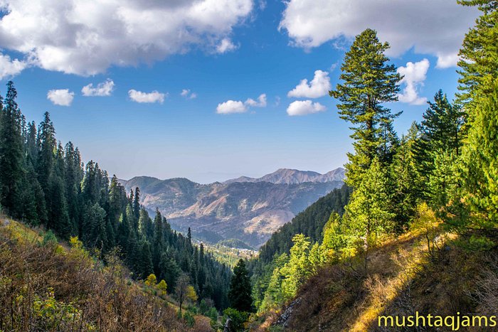
Kalam is worth seeing site in Swat valley. Kalam is located at the distance of 100 km from the mingora, in the northern upper part of Swat valley. It is located at the bank of Suvastu river in KPK province.Kalam is encircled by green hills
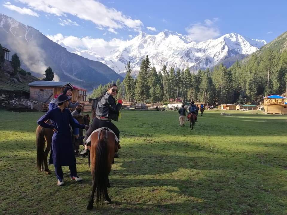
Visitors to Fairy Meadows can find accommodation in small on-site cabins or designated camp sites (the Pakistani government declared the location a National Park in 1995).
.jpg )
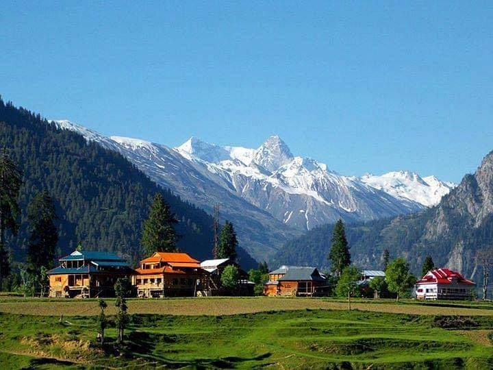
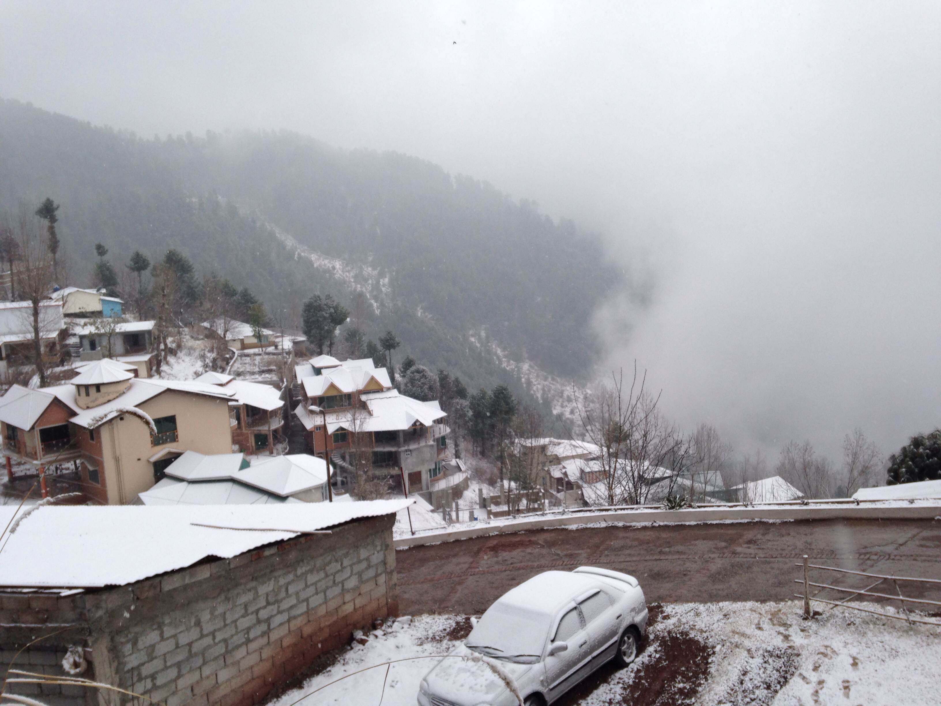
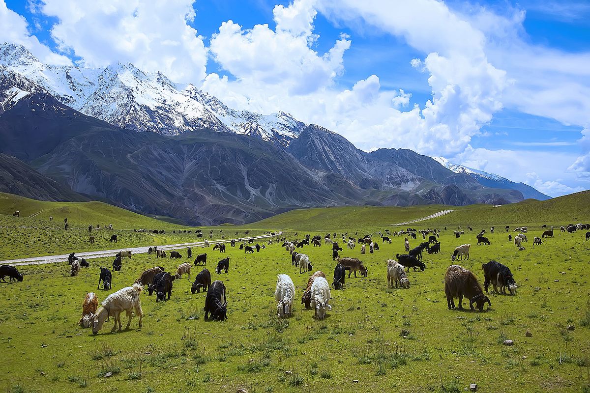
Naran Valley, holding many gems of beautiful Pakistan, faced a disastrous earthquake in 2005, revived its tourism since then. The assortment of mountains, lakes, meadows, and streams that are as fascinating in winter as in summer, is the best place to visit in any season.
The Hunza Valley is a mountainous valley in the northern part of the Gilgit-Baltistan region of Pakistan, formed by the Hunza River, bordering Ishkoman to the northwest, Shigar to the southeast, Afghanistan's Wakhan Corridor to the north, and the Xinjiang region of China to the northeast.
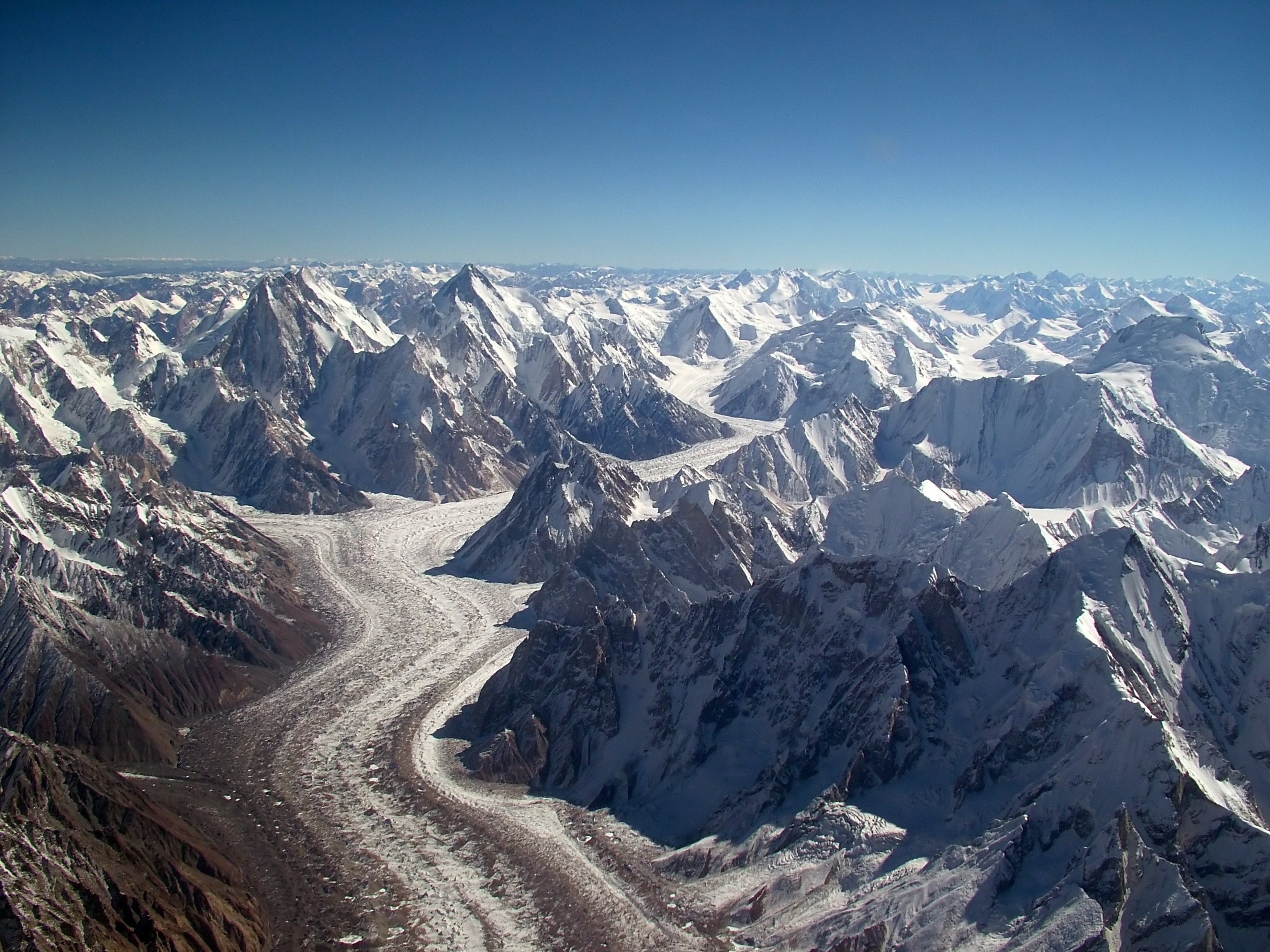
The Karakoram is a mountain range in Kashmir region spanning the borders of Pakistan, China, and India, with the northwest extremity of the range extending to Afghanistan and Tajikistan. Most of the Karakoram mountain range falls under the jurisdiction of Gilgit-Baltistan, which is controlled by Pakistan.
Murree, Kahuta, Kotli Sattian, parts of present day Haripur and Abbottabad districts formed part of the Khakhar governorship. The Hazara plains, present district of Haripur were part of Attock district while the Mansehra region, then called Pakhli sarkar was governed from Kashmir.
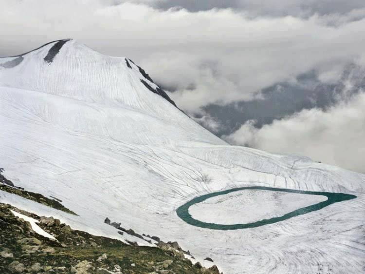
Ansoo Lake, is a tear-shaped lake located in Kaghan Valley in Mansehra District of Khyber Pakhtunkhwa the province of Pakistan. It is located at an elevation of 4,245 metres above sea level and considered one of the highest lakes of the Himalaya Range.

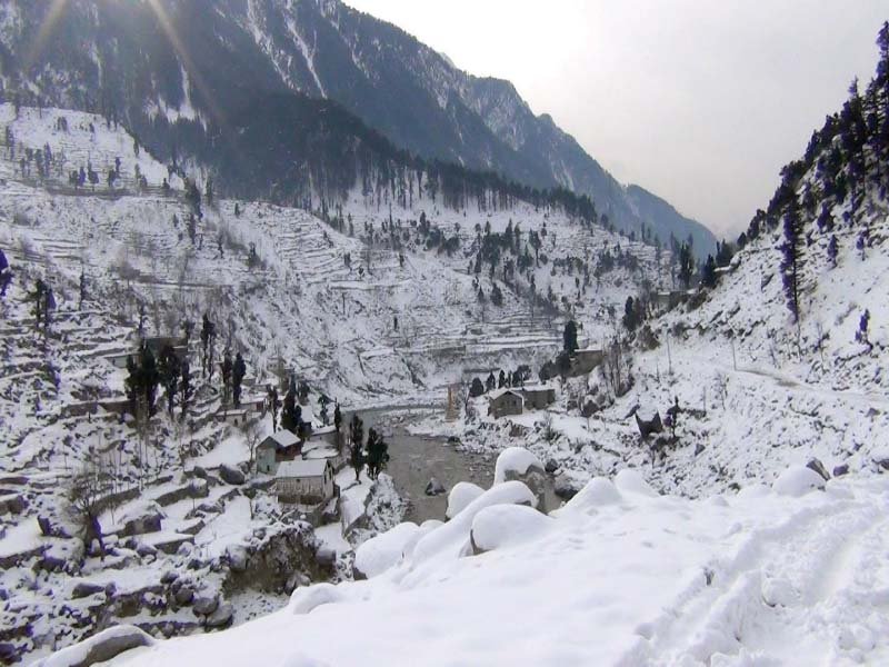
The district of Neelum is the northernmost of 10 districts located within the Pakistani-administered territory of Azad Kashmir. Taking up the larger part of the Neelam Valley, the district has a population of around 191,000 people. It was among the worst-hit areas of Pakistan during the 2005 Kashmir earthquake.
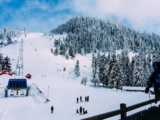
Malam Jabba (also Maalam Jabba, Urdu: مالم جبہ) is a Hill Station and ski resort in the Hindu Kush mountain range nearly 40 km from Saidu Sharif in Swat Valley, Khyber Pakhtunkhwa Province of Pakistan.
.jpg)
Kumrat (Urdu: کُمراٹ) is a valley in the Upper Dir District of Khyber Pakhtunkhwa province of Pakistan. Kumrat Valley is located about 45 minutes away from the town of Thal on the banks of the Panjkora River, and is among the most popular tourist spots in Khyber Pakhtunkhwa.
Nathia Gali or Nathiagali is a hill station and mountain resort town located in the Abbottabad District of Khyber Pakhtunkhwa, Pakistan. It is located at the centre of the Galyat range, where several hill stations are situated
Chitral, also spelled Chitrāl, Chitrār, or Qāshqār, town, northern Khyber Pakhtunkhwa province, Pakistan. The town lies along the Kunar River (also known as the Chitral River) in a valley 2 miles (3 km) wide, at an elevation of about 4,900 feet (1,490 metres) above sea level.
.jpg)
.jpg)